CoMaps is a community-led, free and open source offline maps and navigation app for Android, iOS, macOS and Linux, built on OpenStreetMap data and aimed at people who want turn-by-turn navigation without tracking, ads or data collection.
What it is
CoMaps is a C++ navigation application licensed under the Apache License 2.0. It is a fork of Organic Maps, which was itself originally based on Maps.ME, and it positions itself as a community-led project governed for transparency, privacy and not-for-profit values rather than commercial return. The application ships on Android, iOS, macOS and Linux, and it is distributed through the App Store and Google Play as well as built from source.
The concrete problem it solves is navigation that depends on a live connection and on the data collection practices of commercial map providers. CoMaps works offline first: maps are downloaded ahead of time and the app then routes without a network, which matters on hiking trails, cycleways and rural roads where coverage is absent. Its map data comes from OpenStreetMap and includes detail the README explicitly notes is not available with Google Maps, so the replacement here is a proprietary, always-online navigation app rather than an additional layer on top of one.
Key capabilities
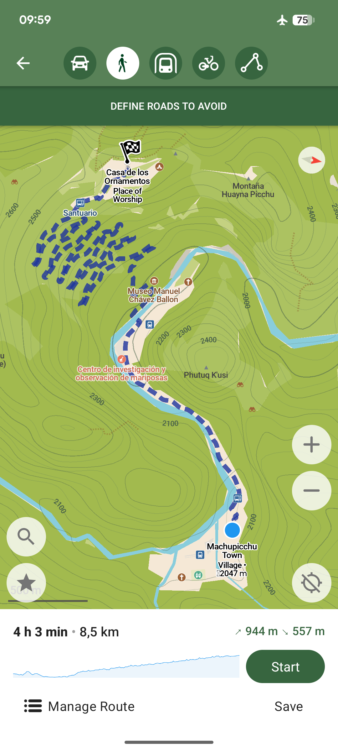
- Offline navigation with voice announcements for walking, cycling and driving.
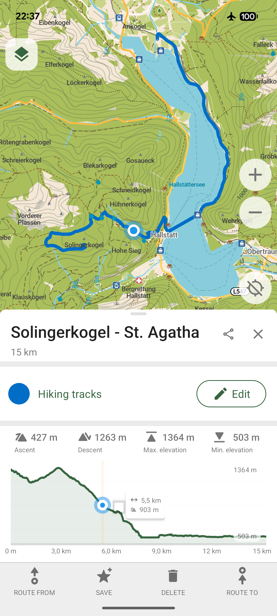
- Downloadable detailed maps covering outdoor information such as hiking trails, campsites, water sources, peaks and contour lines.
- Export and import of bookmarks and tracks in the KML, KMZ and GPX formats.
- Offline Wikipedia articles, a subway transit layer and subway directions.
- Track recording and one-tap bookmarking of favourite places.
- A basic built-in editor for improving OpenStreetMap data directly from the app.
- Android Auto and CarPlay support, alongside a dark mode for night use.
Who uses it and how
- Hikers, cyclists and drivers who need routing in areas without mobile data, using pre-downloaded maps and the outdoor mode with highlighted trails and water sources.
- Privacy-conscious Android users, for whom the app has been reviewed by Exodus Privacy and distributed with published signing certificate fingerprints verifiable through
apksigner and AppVerifier.
- Contributors who build from source following
docs/INSTALL.md, work to the guide in docs/CONTRIBUTING.md, and coordinate through a dedicated Zulip chat for team messaging.
- Supporters funding development through OpenCollective or Liberapay, with financial information kept open and transparent at the project's Open Collective.
- In-car users relying on Android Auto and CarPlay integration for driving navigation.
Getting started
Install from the App Store or Google Play for everyday use, or build from source by following the instructions in docs/INSTALL.md.
How it compares
Within this registry it sits directly in the lineage of Organic Maps, the project it forks, and Maps.ME, the application that lineage originally came from. Against Google Maps, the contrast the README draws is the offline map detail and the absence of tracking, ads and data collection, with OpenStreetMap as the underlying data source rather than a proprietary dataset.
When to use it — and when not to
Choose CoMaps if offline navigation, OpenStreetMap data and verifiable privacy matter more than the polish of a large commercial provider, and if building from source per docs/INSTALL.md or installing from a store is acceptable. Do not pick it expecting a hosted service or a container deployment: the facts describe a client application with store distribution and a source build, and nothing more. The README is a highlights and funding document rather than a detailed technical specification, the topic list is empty, and the issue tracker lives on Codeberg rather than GitHub, so anyone evaluating it for a workflow should expect to read the repository documentation rather than the landing page.
project readme (upstream, from github) — read inline
Project Intro |
Governance |
FAQ |
Contribute |
Donate |
Keep Connected

Hike, Bike, Drive Offline - Easy Map Navigation with Privacy


A community-led free & open source maps app based on OpenStreetMap, built for transparency, privacy, and not-for-profit values. A fork of Organic Maps, originally based on Maps.ME.







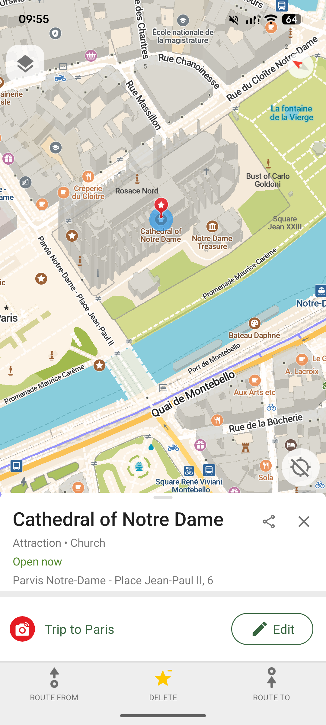
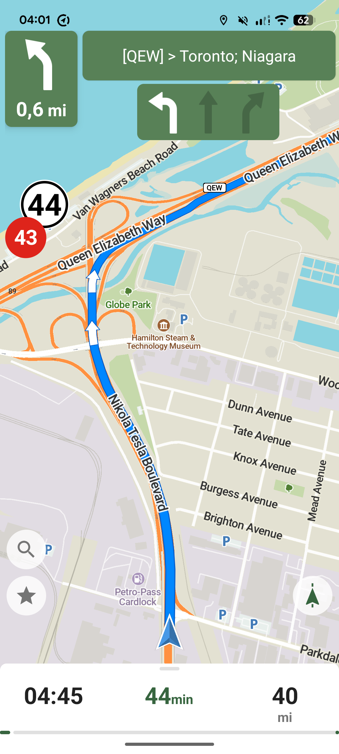
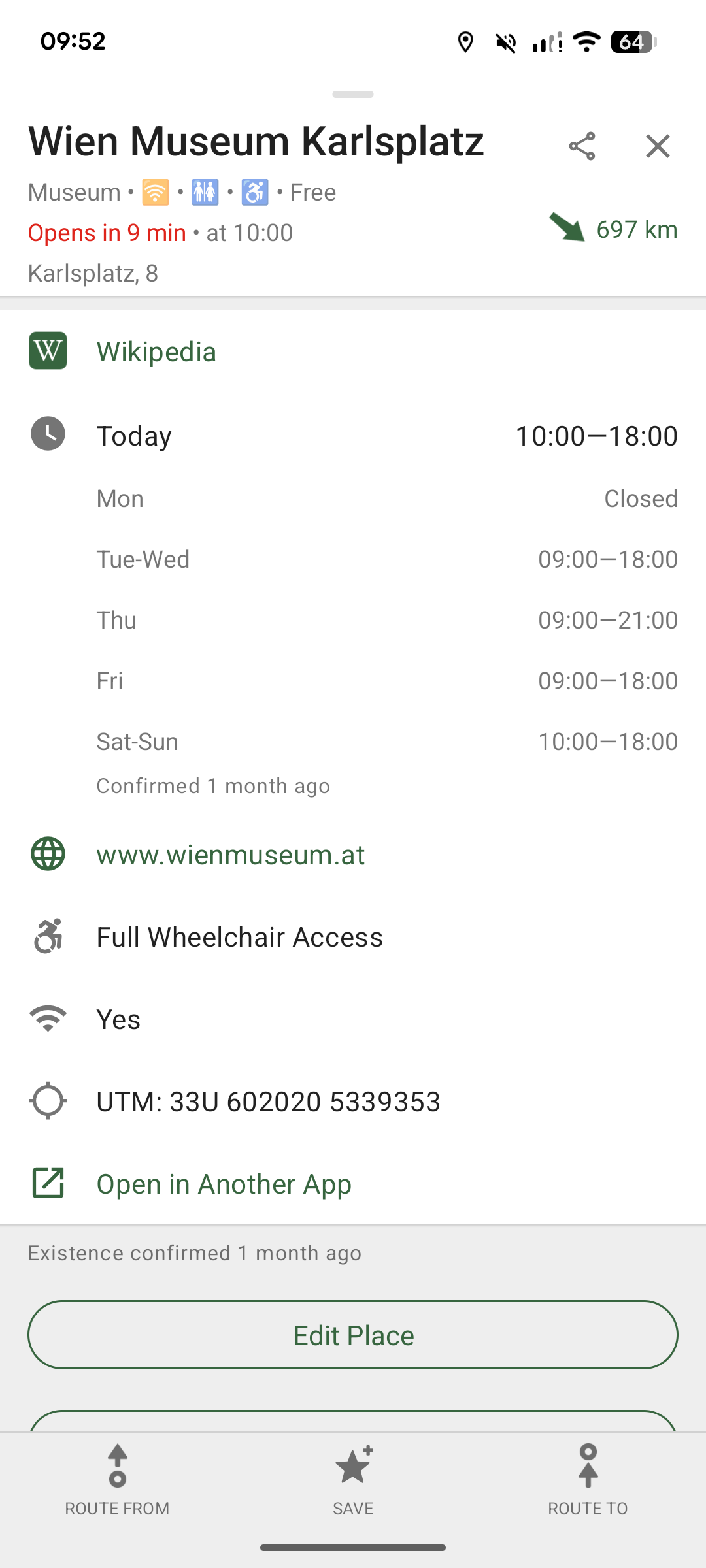
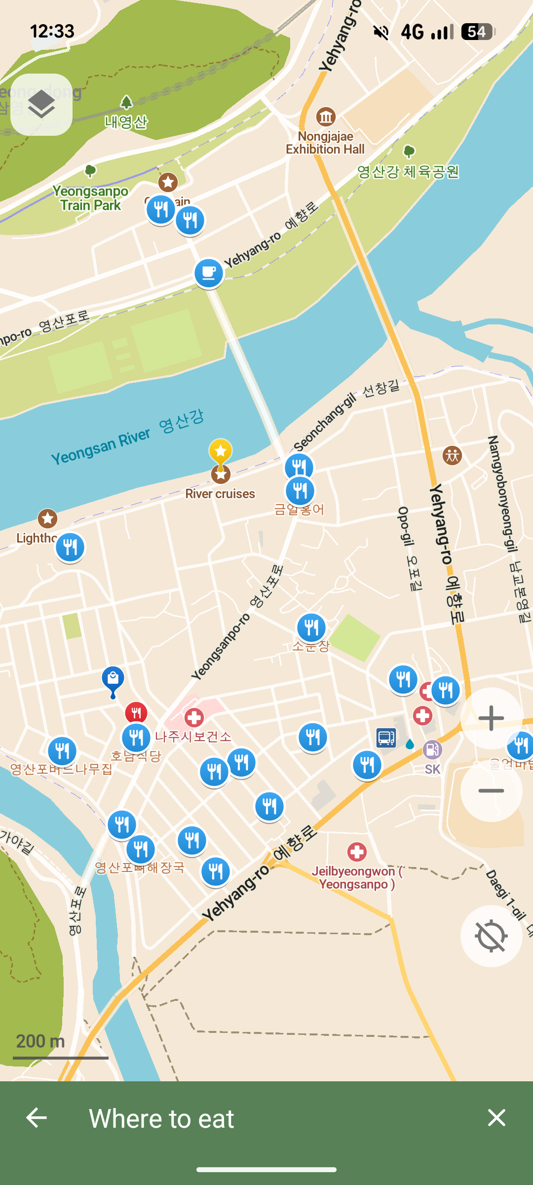
⚡️ Highlights
- Offline-first: Navigate without a connection
- Privacy-respecting: No tracking, ads or data collection
- Lightweight: Battery- and space-efficient
- Simple: Polished, user-focused interface
- Cross-platform: Available for Android, iOS, MacOS, and Linux.
- Community-built: Free, open source, and collaborative
- Transparent: Open finances and governance
🚀 Main Features
Downloadable detailed maps with places which are not available with Google Maps
Outdoor mode with highlighted hiking trails, campsites, water sources, peaks, contour lines, etc
Walking paths and cycleways
Points of interest like restaurants, gas stations, hotels, shops, sightseeings and many more
Search by name or an address or by point of interest category
Navigation with voice announcements for walking, cycling, or driving
Bookmark your favorite places with a single tap
Offline Wikipedia articles
Subway transit layer and directions
Track recording
Export and import bookmarks and tracks in KML, KMZ, GPX formats
A dark mode to use during the night
Improve map data for everyone using a basic built-in editor
Android Auto and CarPlay support
Freedom Is Here – Navigate the world with privacy and community at the forefront.
🤝 Contributing
You can help by donating, contributing code, translating, or by telling others about it. To build the best maps app there is a need for software development, design, product, community development, and other areas. Reach out to us and let us know how you want to help.
There is a dedicated Zulip chat for active contributors.
💬 Feedback
💸 Funding
CoMaps is free. To fund development, we rely on your voluntary support ♥️
Donate via OpenCollective or Liberapay.
The project's financial information is completely open and transparent at our Open Collective.
🔒 Privacy
The Android app has been reviewed by Exodus Privacy.
To verify the APK, use the following signing certificate fingerprints:
SHA-256: 4894e8e6963627ef660031d8593fe77297f835acb4e23810003e926135023b4c
SHA-1: 8b7b5739f917e9f7c681671ced0c9c8562123ade
MD5: 9cce0ffea281dc2f0e0a154d6d2e281e
To verify CoMaps via AppVerifier, use the following signing certificate fingerprint:
app.comaps
48:94:E8:E6:96:36:27:EF:66:00:31:D8:59:3F:E7:72:97:F8:35:AC:B4:E2:38:10:00:3E:92:61:35:02:3B:4C
⚖️ License
Licensed under the Apache License 2.0.
See LICENSE, NOTICE, and data/copyright.html.
Our project is completely free and open source software. It had been reviewed by "is it really FOSS?" and is listed as 100% FOSS, see what that means